Program for the Study of Developed Shorelines
Science. Policy. Education. Outreach. Coastal.
Horry County SC Supplemental Flood Zone
Download the Project Description here
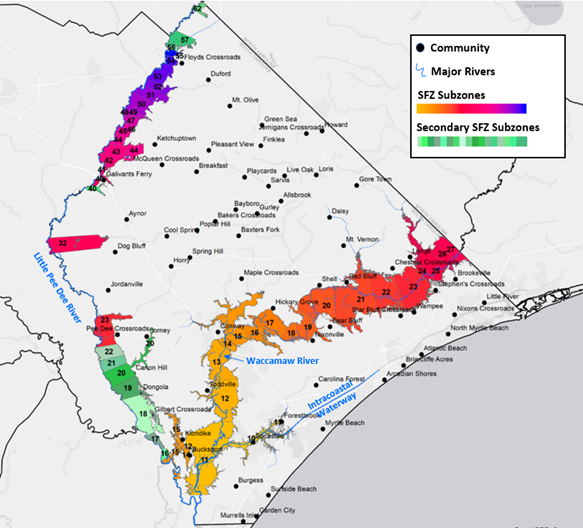
The proposed Supplemental Flood Zone (SFZ) is a unique product that utilizes historic flood data to map estimated flooding during recent storms. This SFZ product and methodology is different than Federal Emergency Management Agency’s (FEMA’s) probability-based Flood Insurance Rate Maps (FIRMs). The Horry County SFZ is an estimation of flood level and extent during Florence using field data, while FEMA FIRMs represent a modeled probability of future flooding. The SFZ can be simply informational or can be used for planning, emergency management, and/or regulation. The SFZ was created by Western Carolina University (WCU) as a part of resilience planning for Horry County, South Carolina.
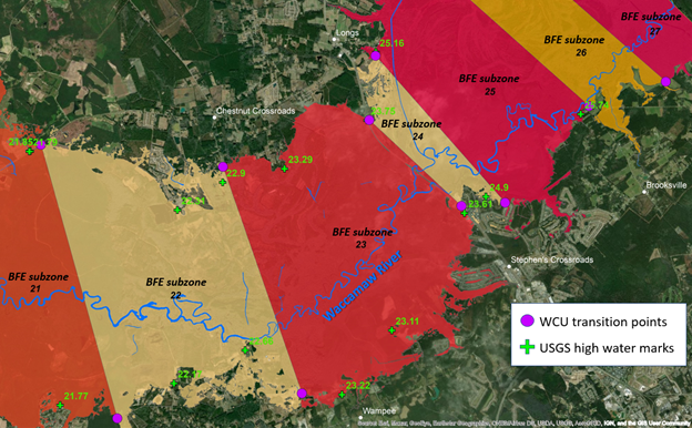
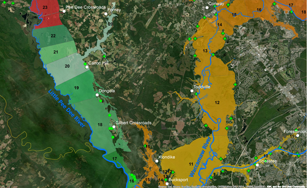
The primary objectives of this mapping exercise were to utilize field-collected, post-storm data of flood elevations from Hurricane Florence within Horry County to: 1) delineate a SFZ independent of the FEMA Special Flood Hazard Area, that approximates the actual extent of flooding during Florence (the storm of record); and 2) create subzones within the SFZ, each with an adjusted Base Flood Elevation (BFE) based on the flood elevations recorded during Florence.


News about the Horry County Supplemental Flood Zone
WBFB News, 2021 https://www.wmbfnews.com/2021/02/20/horry-county-reveals-new-flood-zone-map-more-county-risk-than-previously-known/
The Post & Courier, 2021 https://www.postandcourier.com/myrtle-beach/news/horry-county-launches-tool-that-can-help-can-help-identify-flood-zones/article_e743ab80-a43f-11eb-8250-6705ff30c8b3.html
The Post & Courier, June 2021 https://www.postandcourier.com/myrtle-beach/more-than-30-years-since-last-update-flood-ordinance-in-horry-county-likely-to-be/article_62de67ee-cd12-11eb-90ae-bbcbf4a55c84.html
My Horry News, 2021 https://www.myhorrynews.com/news/local/horry_county/horry-leaders-discuss-scaling-back-building-requirements-in-county-flood-zones/article_62e82fbe-5a37-11ed-bc15-f74ed072cd8e.html
ABC 15 News, 2022 https://wpde.com/news/local/facing-legal-challenge-horry-county-council-eyeing-major-change-to-flood-protection-law
My Horry News, 2023 https://www.myhorrynews.com/news/local/horry_county/hoary-county-council-delays-vote-on-flood-ordiance-change/article_f635cf92-b2b6-11ed-b44e-b74e28de73e2.html
Program for the Study of Developed Shorelines
Old Student Union
Western Carolina University
Cullowhee, NC 28723

